Saturday, February 27, 2010

Who's Reading This Blog Anyway?


By Anonymous

Sadly the data are in, and enough time has passed to reach a scientific conclusion about the efficacy of photographs such as this to attract and retain readers to our blog. On the bright side, there is no evidence that this type of blatant and crass ploy has turned away eyes. Personally, I didn't think this would happen, but now we have confirmatory objective data, and not just my own beliefs (however prescient and on-target). That said, on a downright depressing note, the data do not show that "fishing babes" (is this term PC?) have the ability to drive hordes of new readers, or for that matter, any new readers to our site.

With these conclusions now "hard facts," a question goes out to the Crew. Should we discontinue the Fishing Babe post category, given that they appear to lend zero value to the site's inherent appeal? Or do we continue with a fruitless investment in their creation, in the hope that someday, somehow, they might deliver a return? I leave it up to the Crew's impeccable good judgement.

New Blog Feature: Diamond Shoals Weekend "Fishability" Tracker! Also: How We Get Royally Screwed

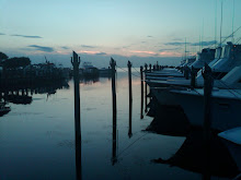
Station 41025 (LLNR 640) - Diamond Shoals
35.006 N 75.402 W (35°0'22" N 75°24'7" W)


By Jim Field

As weekend sportfishermen (that's us!) we live and die by weather conditions that happen to develop--by pure chance, of course--for the weekend: 2 days out of 7, or 28.6% of daily fishing opportunities in a week. Given this highly circumscribed time frame, imposed upon us by the twin commitments of work and family--and, why not go to the beginning, to the unfortunate fact that none of the Crew is the deserving beneficiary of inherited wealth--it's often the case that we get screwed, royally screwed. Why is this the case?

Well, for starters, weather is unpredictable--I mean, it sets the benchmark on uncertainty. If (1) you can only fish on certain days of the week, and (2) these designated days make up just over a quarter of days in a year, and (3) good weather develops randomly, and (4) is a subset of potential weather patterns, and (5) you can only fish in good weather, then walla--do the math!!!!--you're not going to end up on the water very often! (Meaning, you're getting screwed.)

And then there's a second form of "getting screwed" to consider. The process goes like this: in arranging a fishing weekend, we spend valuable spousal capital to get a "free pass" for an upcoming weekend. (These chits, I'll note, are difficult to secure.) Then the weekend rolls around and the weather is, let's say, terrible. So, you don't go fishing, and you don't use the free pass, but--and here's the catch!--you are unable to hand it back at face value. Oh nooooo! Because you asked for the pass, and received it, and the weekend agreement was in fact consummated, you wind up using some of the free pass' goodwill. So, next time around, getting a free pass will be even more difficult--because in not going fishing, you nevertheless had reserved and been bestowed time to fish, and so you used 20% of the pass, which is applied by one's spouse as a weighting factor in determining the odds of fishing in the future. Now that, in my book, is also getting royally screwed, part II.

In our group commiserations, about the punitive nature of imposed marital scheduling practices, and in particular, the cruel fates of fishing weather, we have noted, however, our impression that weather patterns this last fall have been particularly unkind to us, the weekend sportfishermen. Not that we're developing a persecution complex, or anything, but it is beginning to get us down. Now, we don't have data on this, but it seems as though at least 50%, maybe as high as 60%, of absolute weekends have been purse washouts, with even higher percentages applicable to weekends we explicitly reserved for an outing.

Alas, upon awakening this morning, and checking out the weather, and finding it, predictably, just horrible (insert primordial yell: Ahhhhhhhhhhhh!), I'm thinking that we should bring some science to this whole issue. Instead of guessing the record on weather, perhaps if we had hard data, we could turn this in our favor. Specifically, if we could quantify our bad luck, perhaps this would create some spousal empathy for our plight, and we could use this to (1) secure fishing weekends more easily and with enhanced flexibility built in, and (2) help restore full value of our returned free passes.

So, from this day forth this blog will track weather at Diamond Shoals buoy for each weekend across the year (we can also do this for the Delaware light ship buoy). This new blog feature can be found in the right-hand column, at the very bottom, the last box of test. The data collected and shown will be presented as follows, using this weekend as an example:
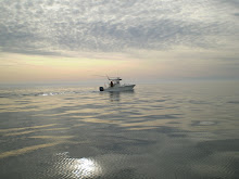
February 27-28
Reserved: No
Sat--WDIR WNW, WSPD 31.3 kts, WVHT 12.8 ft
Sun--
Verdict: Unfishable

Personally, this will be fascinating to track. I mean, what other Crew has this kind of data on hand? It could really make science work for the betterment of mankind (i.e., us). I'm certainly going to make sure that my "loving spousal unit" (LSU) is kept appraised of the latest aggregated numbers.

Wednesday, February 24, 2010

Day Trip to San Diego: Part II. Memorial to the Tuna Fleet

By Jim Field

This is the second entry from my day trip to San Diego a few weeks back. The first entry introduced the esteemed San Diego Marlin Club. Well, right down the road on Shelter Island, right along the channel leading from the harbor to the ocean, on an absolutely beautiful spot of dry land, I came across a monument--the "Tunaman's Memorial"-- to San Diego's historic tuna industry--and in particular to the men who served in this fleet, and among them, those who over the years were lost at sea. Tuna as big business in San Diego goes back to the previous century. At one time, perhaps spanning the 1930s to 1970s, the fleet was comprised of hundreds of boats. During World War II, if fact, many of the boats were commandeered by the US Navy and posted into action throughout the Pacific.

The monument is large but not Sovieteque in proportions. It's compact and very nicely done. On the marble wall where names are carved, the following inscription is written:

"Remembering those that built an industry and remembering those that departed this harbor in the sun and did not return."

God Bless these men. Today the fleet is mostly gone, as are the fish they went to sea to catch and kill; alas, they did their jobs way too well. What is left--for one, this arresting yet hollow recreation--cannot convey what it must have been like in the heyday of tuna fishing--the scores of boats, the legions of men, the commerce and money and wealth, the accidents, and the beauty and cruelty of it all.

Bringing in the big ones--rod, reel, muscles, and backs


Another vantage point, looking toward the channel


The wall with inscribed names of Captains, boats, and the lost


The most-recently departed (photographer reflected)

Tuesday, February 23, 2010

Repairs at Pirate's Cove--Ready to Go! Newport News Scallop Fleet Photos

By Jim Field

Today I drove down to Pirate's Cove with a single purpose in mind: to get the Sea Ya Bea's generator up and running again. Mission accomplished. Left the house at 5:00 am and met Danny the mechanic from Gregory Poole Power Systems (out of Wanchese) pier side. Danny is an ace with Westerbeke's, and had it running in 10 minutes. Problem turned out to be loose connections on the bus bars due to screws backing off over time with vibration. He then went on to check out fuel filter, impeller, heat exchanger, belt, and replaced single zinc. Spoke to me about care and maintenance tips. Fantastic guy! Will use him again--every time.

(Note: yesterday Danny worked on a new-construction Spencer 52, installing Cat engines rated at 1,900 horsepower each. He said the engine room was beautiful.)

The day was overcast, windy and chilly. Yesterday was 55 and warm. The marina was dead--no one around. I performed some other maintenance items (Clorox bleach in fresh water tank, fuel treatment additive in fuel tank, checked lines), and then headed back.

Working my way through Norfolk, and then upon exiting the tunnel into Newport News, I spotted a fishing fleet to my immediate right and exited the highway. I had noticed these boats before, just never had time to stop. Today I did. I walked up and down the peer and found some men working on one of the boats. I asked what the fleet fished for. One man, a friendly sort, said scallops. Here's a few other things he told me:

- there are about 450 permits for scallop fishing on the east coast
- about 20 part-time permits
- the fishery is highly regulated
- he has been Captain of his boat for 20 years, but did not own it
- he fished off Cape Cod mostly; they rotate the open fishing grounds
- can fish as north as Newfoundland
- his boat hadn't been out since September 10
- I asked him how they made a living at this
- he responded: you make a lot when you catch them
- he volunteered that he made $120,000 a year from this, working 6 months

Up close, many of the boats are battered and ill-kept. Remember: every year we hear about scallop boats sinking off Maryland and Virginia, attributed by survivors to poorly-maintained vessels.

Here are a few pictures from today:

Repaired, fueled, filled, charged, and ready to go


The fairway at Pirate's Cove--very, very quiet


One of the veteran scallop boats


Man who owns these, owns five more just like them

Heavy planers at top are lowered into water for stability


Controlling the moving rigging from a protected house


All in all, a good day today. Let's pray for time to fish and good weather.

Friday, February 19, 2010

The Dixie Arrow--Dan's "Go To" Wreck. Putting Flesh on the Rusting Bones


By Jim Field

On the subject of ship wrecks (see prior post on the USS Monitor), I thought I would put together a piece on the Dixie Arrow, which we oftentimes visit--right out of the gate--upon clearing Hatteras Inlet on the way to deeper water heading ESE on the compass rose. On a few visits, we've been very successful, catching dozens of triggerfish, sea bass, cobia (a "free gaff" courtesy of Dan)and other wreck dwellers. We've also seen swarms of amberjacks and the occasional huge shark. Conversely, on other visits we've come up short (that's fishing, right?). From a fisherman's perspective, the positive aspects of the Dixie Arrow are that it's relatively close to shore and in shallow water (say, 80'). The downsides are exactly parallel: close to land and shallow, which means that it's also a favorite dive site, which we suspect has something to do with lack of fish, the theory being that divers pick off fish of any value. (Note: we could be totally wrong about this; don't we all look to explain the inexplicable?)

On the fishfinder, the Dixie Arrow presents a clear-cut, easy to find target. The ship's profile, nicely presented in the photo, wouldn't appear to support this: pretty flat except for front and aft houses. Of course, the ship, being a tanker, was deep-drafted and constructed of tons of hidden steel plate; it also sank violently, which means sections of it settled in a twisted heap.

Exactly how and why did the Dixie Arrow perish, and become, over 60 years later, a "tool" for the Crew? The following excerpt is from a really cool website, produced by the Association of Underwater Explorers, that charts all the wrecks off Hatteras Inlet--our fishing grounds!--and provides thumbnail sketches (upon click-command) of each doomed vessel. (Note: go to "Useful Links" in the right-hand column of this blog to access the website at "Ship Wrecks--Hatteras".)

The Dixie Arrow was a 468' long tanker that was torpedoed off Hatteras, North Carolina, 26 March 1942, by the German submarine U-71. She remained afloat, purging crude oil, flames, and profuse quantities of black smoke, visible for miles. She eventually settled in 90' of water on a clean sandy bottom. The bow rises almost 30' off the bottom, with the skeletal frame intact for 80' until it breaks down into jumbled debris.

Anchor chain fills the bow space, with a hull plate holding a couple of portholes peeled off and laying in the sand below the portside quarter. There are deep washouts directly under the bow where copious supplies of seashells collect -- a great location for a malacologist. The main part of the wreck is a mass of twisted steel, though contiguous and with several landmarks. The three boilers, followed by the large engine are visible as one heads aft. Brass valves and an occasional gauge are found throughout this area. The stern boasts the bronze propeller, buried in the sand. About 60' off the starboard side of the stern, the remains of the superstructure lie half-buried in the sand. The Arrow is a popular wreck, home to several resident sea turtles and sand tiger sharks.

I've put together recent photographs of her remains. Easy to see why we pick her up so well via sound waves.

Masts and jutting superstructure


Two of three huge boilers (engine in background)


The ship's engine


Decks, bulkheads, and chain


Look what's hiding--a toadfish


May she rest in peace. And....provide us lots of tasty treats!

Thursday, February 18, 2010

USS Monitor: What Lies Beneath. What Do We Know of Her Death?

By Jim Field

Question for the Crew: Where do you know this text from?

AMZ152-154-191515-
S OF OREGON INLET TO CAPE HATTERAS NC OUT 20 NM-
S OF CAPE HATTERAS TO OCRACOKE INLET NC OUT 20 NM
INCLUDING THE MONITOR NATIONAL MARINE SANCTUARY-
1014 PM EST THU FEB 18 2010

SMALL CRAFT ADVISORY IN EFFECT UNTIL 9 AM EST FRIDAY

OVERNIGHT
NW WINDS 20 TO 25 KT. SEAS 3 TO 5 FT. DOMINANT PERIOD
6 SECONDS.

FRI
NW WINDS 15 TO 20 KT. SEAS 3 TO 5 FT DOMINANT PERIOD
4 SECONDS.

ETC......


The answer, of course, is the sea/weather forecast for Diamond Shoals buoy off Hatteras, NC. What's always caught my eye and imagination in particular, however, when reading the forecasts, being that I'm a naval and Civil War aficionado, is that the area covered encompasses the "Monitor National Marine Sanctuary," i.e., the site where the ironclad USS Monitor foundered and sank, entombing some of its crew in a steel coffin.

During our many trips traversing this area of open ocean, we've probably passed close to the Monitor site--perhaps passed right over the top of it--without ever taking notice. We know it's there, but we don't think about it. And not thinking about it, we don't know of its circumstances--how it came to find it's way there, to disappear from the surface, plunging downward into the silent depths.

Given our love for this area--it's special meaning in our lives--I thought it would be interesting to find out about her last day and moments, and why she sank where she did. Did it happen at night, or day? Did a storm bring her down, or some freak accident in a calm sea? Perhaps if we know her story, we'll appreciate this little chunk of the planet that much more. Perhaps it will be a fitting way to honor the memory of her unfortunate crew. The narrative goes like this:

USS Monitor--Loss of the Ship, 31 December 1862
After a hot summer of routine duty in the Hampton Roads area, Monitor badly needed an overhaul. This work, done at the Navy Yard in Washington, D.C., fitted the ship with a telescopic smokestack, improved ventilation, davits for handling her boats and a variety of other changes to enhance her fighting power and habitability. She returned to the combat zone in November 1862, remaining in vicinity of Newport News for the rest of that month and nearly through the next.

In December, Monitor was ordered south to join the blockading forces off the Carolinas. After preparing for sea, on 29 December she left Hampton Roads in tow of USS Rhode Island, bound for Beaufort, N.C. The weather, expected to be good for the entire voyage, stayed that way into the 30th, as the two ships moved slowly along, several miles off the North Carolina coast. However, wind and seas picked up during the afternoon and turned to a gale by evening. The Monitor labored heavily as she neared Cape Hatteras, famous for its nasty sea conditions. Water began to enter the ship faster than the pumps could expel it and conditions on board deteriorated dangerously.

Shortly before midnight, it was clear that Monitor was in grave danger. Her steam pressure was fast failing as rising water drowned the boiler fires. The tow line was cut, the anchor dropped, and distress signals were sent to the Rhode Island. Boats managed to remove most of the ironclad's crewmen under extremely difficult conditions, but several men were swept away. Finally, at about 1:30 in the morning of 31 December 1862, the historic Monitor sank, to be lost to human sight for nearly 112 years. Sixteen of her crew of sixty-two were lost with her.


Here are some amazing photographs of the Monitor's grave. Obviously, sea conditions must have been very benign on the day of this visit.

Overview of the hull


The circular turret


The bow section


A stunning mosaic

Newswire from TBF: Purse Seine Permitting Threatens Fishing in the Bahamas


By Jim Field

Commercial fishing is evil. (Note: Alaskan crabbers and East Coast lobstermen are the exceptions--both "get it" when it comes to sustainable fisheries.) Yes, an extreme position to take, but as a sportfisherman I think it's a principled one. We want a sustainable fishery; they want to monetize the fishery today to put money on the table. I think they should go find other work, and their governments should force the issue. Here's information out of the Bahamas to process.

TBF Friends,

If the Bahamas completes its permitting that would authorize commercial purse seining of tuna in the waters of the Bahamas, the negative impact will kill the sportfishing tourism industry in the nation. Such a large scale net vessel will have bycatch not only of blue marlin, white marlin, sailfish and spearfish; it will also inadvertently kill marine mammals as well as endangered sea turtles. Why would a nation that has demonstrated responsible fishery and ocean management for years now take huge steps backwards, steps that could economically and ecologically permanently damage the entire archipelago?

Recent socio-economic studies completed by The Billfish Foundation (TBF) document that responsible sportfishing of billfish, primarily catch and release, generates far more economic return to a nation than large commercial vessels that take, kill and move on to others waters while only having to pay a few license and permit fees. Once vessels like this are permitted to fish the region, the nation's waters become depleted of many marine fish that are indicators of the health of their ecosystems. Large pelagic fish like billfish and tuna help support a number of jobs and industries throughout the Bahamas; their presence in the waters is important also for balancing the functions of the ecosystems.

TBF is sending its economic and scientific data to the Prime Minister and other important officials in the Bahamas in hopes that they see the huge error of someone's poor idea and halt it before the purse seine vessel can ever make one set. TBF President Ellen Peel is prepared to go to the Bahamas immediately with scientists and reports to talk with officials about what they are considering. TBF appreciates the eyes and ears of concerned anglers, captains, mates, hotel and marina owners, tackle shops and tournament directors who have so diligently sought out and shared information with us on this soon to be conservation travesty.


Vessel in Freeport, Bahamas currently being outfitted with mile long, 900' deep, purse seine fishing nets

Wednesday, February 17, 2010

Merchant Ships Pull Back on Throttle. But Will the Porpoise Like It?


By Jim Field

The NY Times reports today that some shipping companies are reducing the speed of their ships for economic and ecological purposes. While transportation has always operated by the rule that speed of delivery is essential, the 21th century standard operating procedure (SOP) might become "slow is better."

The Danish shipping giant, Maersk lines, is one of the new believers. By halving its top cruising speeds over the last two years, the company has cut fuel consumption by 30%, saving bundles. But it also achieved equivalent cuts in emissions of greenhouse gases (carbon dioxide). Travelng more slowly, said a spokesman, "is a great opportunity to lower emissions without a quantum leap in innovation."

The transit time from Germany to China, for example, under lower speeds takes just over a month, a week long than before. The idea first took root in 2008, when oil prices rose to $145 per barrel. The physics are simple: slowing down from high speeds lowers emmisions and fuel consumption by reducing drag and friction as the ship pushes through the water.

Across the world's cargo fleet, more than 220 vessels are practicing "slow steaming," which equates to cruising at 20 knots in open water versus the standard 24or 25 knots. Maersk's vessels go even further, employing "super slow steaming," which produces a speed of 12 knots.

The question remains, however, how the porpoise will react. Will slower speeds proportionately reduce the joy associated with riding the bow waves of these steel giants? Will they need to seek out other sources of fun to get their fix? Or will slower speeds open up new joys for the aged porpoise among them? Only time will tell. We'll keep an eye on it as we fish.

Resting at the pier. Crew takes in church services


Overseeing the automated loading of containers. "Oh, my back."


This is what porpoise can't get enough of

Monday, February 15, 2010

Day Trip to San Diego--Sportfishing Encounters. The Legendary Marlin Club


By Jim Field

As I write, I am in the middle of a one-day trip to San Diego. Started this morning with 5:30 reveille and wheels up from Dulles at 8:15 am. Current time is 12:10 am EST (January 15) with expected departure in one hour, to arrive at Dulles at 6:00 am EST. All this to deliver a one-hour presentation to a group of cancer program executives. Whew! Hoped they liked it; hope they appreciated my effort.

(Break: We boarded, flew across country, landed at Dulles at 5:30 am. I drove home and climbed in bed. Now it's 1:00 pm. Feels good to be home.)

To continue.....after landing yesterday in San Diego, I had a few hours to kill, and decided to head to a favorite place of mine in San Diego proper, Shelter Island. San Diego Harbor is shaped like a banana laid horizontally, with the stem at right pointing north. Coming in from the sea, Shelter Island is on left side of the channel at the curve. SI is known for its hotels, yachts, marinas, and boating clubs, particularly with respect to jaw-dropping sailing vessels. Many America's Cup racers in the past were built and kept in SI, and the money floating on the water in the forms of wood and fiberglass is mind-blowing. That said, it's moored tonnage is only perhaps half of what's parked in all of San Diego Harbor--I've never seen any other city with this type of dedication to boating. (The photo, in turn, shows only about one-quarter of SI boats. Talk about a fleet!)

Driving down SI's one and only road, lined door-to-door on both sides by marinas, yacht sales offices, and ship outfitters of everything imaginable (beautiful stuff and well-stocked shelves), my eye caught a small sign stating "San Diego Marlin Club." I immediately pulled over, parked, and got out to investigate. I walked into a small parking lot and, framing the marina view in front of me, was an aging sign marking the club's domain (see photo). Then looking to the right, I spotted the clubhouse itself, a modest structure from another era, with its double doors opened wide, as if to invite me in. So over I went.

Two men were working outside (their boom-box blasting AC/DC tunes). One fellow told me to walk in and have a look around if I wanted. I went in. A few minutes later he reappeared and introduced himself as Bob Woodard, the club's President. (Notably, his business card states: Captain Bob Woodard, Marlin and Tuna Specialist; California, Baja, and Mainland Mexico; Outfitting and Consulting.) I asked him what the club was all about. His face lit up, and he gave me a basic rundown:

"It's the oldest sportfishing club in San Diego. Founded in September 1931. Current club facility was built in 1952. In the early days, club members developed many of the angling rules adopted by the IGFA. We maintain an active catch report updated daily, and a free, certified weigh station open to the sportfishing public. We have slips available for club members right outside, reserved for 3-day maximum stays (some folks try to 'stretch the rules'). Anyone can join if they're into the sport--although we like to have a recommendation from a current club member. But generally not a problem. We mostly catch tuna, halibut, and stripped marlin. In El Nino years, we'll catch a few blue marlin. You never know, with climate changes we may be back on the blues regularly."

Bob seemed a great guy. He gave me a club brochure; I noticed that annual membership dues are currently $150 for an individual, $290 for a family (including a one-time $50 new membership fee). He invited me to look through their fishing logs--a lineup of binders on a table attesting to a rather long history captured on record. Everything they had, in fact, was open to me if I was interested.

What a neat place. The walls are lined with preserved fish, glass display cases holding countless trophies of every size and shape (randomly positioned), and framed certificates of various fishing records, most of them now well-dated (e.g., a 1940 light tackle record for a 280 lb stipped marlin). In fact, the trophies without exception--at least those that caught my eye--were from a past era, when great fish were abundant and sportfishing was something today's enthusiasts--we unfortunate poor souls--can't even imagine.

After probing around for a bit, I suddenly found myself out of time, and I had to hastily depart. Next time in San Diego, however, I'll stop by again for a longer visit--I'd like to page through their oldest fishing logs and photographs. What a fortuitous find; you never know what you'll come across in travels related to fishing, especially when visiting a great seaport on absolutely stunning water, the Pacific Ocean.

The club's interior: a trip back in time


Trophies here, there, and everywhere


Would like a chance at the fish commemorated


View from club's patio (what's the land worth?!)


This is what the club's brochure writes about their prime catch:

Striped Marlin--Tetrapturus audax--are found throughout the temperate Pacific and Indian oceans and are the most common of all Pacific billfish. True oceanic nomads, stripers have been known to cover great distances in short periods of time. Several tagged fish have been recaptured after traveling distances of over 4,000 miles! Their northern boundaries include the waters off Southern California, where they commonly occur in the summer months from June through November.

"Finning" fish are often spotted on the surface where they are baited with live mackerel. Stripers also readily take artificial lures. A highly prized gamefish, striped marlin are considered the most aerobic of all billfish. Long greyhounding runs of 20 or more jumps are the trademark reward for anglers who pursue this elusive quarry.

It is believed that striped marlin can grow to a maximum size of over 600 pounds. The majority of marlin captured in Southern California/Baja waters average between 100 and 200 pounds. The IGFA all tackle record is 494 pounds, caught in New Zealand. The California state record was captured in July of 1985 by club member Gary Jasper and weighed 339 pounds.


Final Note: the club is proud to be affiliated with the IGFA and my favorite charity cause: the Billfish Foundation. Thanks for your support of TBF, Bob! Catch and Release!

Saturday, February 13, 2010

Pretty Much a Routine Day with the Marlin--Right! Count Them: 15!


By Jim Field

A few summers ago the Okoniewskis and Fields--men only, so Fran (Jr.) and Jack, Dan, and then Andrew and me--were working our way north from a fishing trip in Hatteras Village when we stopped at Oregon Inlet Fishing Center to check things out. (As a rule, we never pass by OIFC without stopping.) The date was August 1, 2008; the weather was sunny and warm; and the boats had come in from a day of fishing perhaps an hour before our arrival. Working our eyes up and down the twin rows of charter boats, we spotted a vertical blue chain of flags flying--catch and release flags for marlin. Amazing.

We walked to the boat and chatted with the mates. No big deal for them, really, just had a "good day." Of course, from my perspective, if I hook up and release that many marlin by the time I'm sixty, it will have been a "good" sportfishing career! I suppose it's what you know, and what you're used to. For me, that translates into knowing too liitle, and expecting too much. That said, I'm looking forward to hooking into multiple marlins this summer. Can't wait! It will happen.

Andrew, Fran (Jr.), and Jack in front of the boat. (Proves we didn't fake picture on a computer.)